Date: December 7, 2025
Place: I spent the weekend at the house of Diana Clements, a fellow tracker, who lives in a remote, forested area of the Parry Sound District, east of Highway 400, north of Nobel, and southwest of Nine Mile Lake, surrounded by lakes and wetlands. We used this location as a base for tracking in the area. On the 3rd day (Sunday, Dec 7), we tracked close to Diana’s house (also in the Parry Sound District, along Highway 69, situated north of Nobel, south of Woods, and east of Carling, near Round Lake Provincial Nature Reserve).
Weather conditions: approximately 6 inches of fairly fresh snow was present, with light additional snowfall occurring sporadically. Temperatures ranged around the −10 °C mark.
References:
– [1] ‘Mammal Tracks & Sign: A Guide to North American Species’, Mark Elbroch, Stackpole Books (1st Edit), 2003
– [2] ‘The Tracker’s Field Guide: A Comprehensive Manual for Animal Tracking’, James Lowery, A Falcon Guide (2nd Edit), 2013
– [3] ‘Bird Tracks’, J. Poppele, Adventure Publications, 2023
Observations:
We began by driving along Hwy 69, scanning the thin layer of snow for tracks. At a snow-plow turn-around, we found a deer carcass dumped by hunters. Numerous ravens were nearby, feeding on meat scraps. The raven tracks around the carcass were remarkably clear.
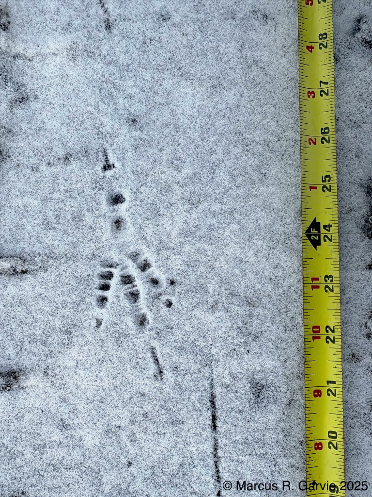
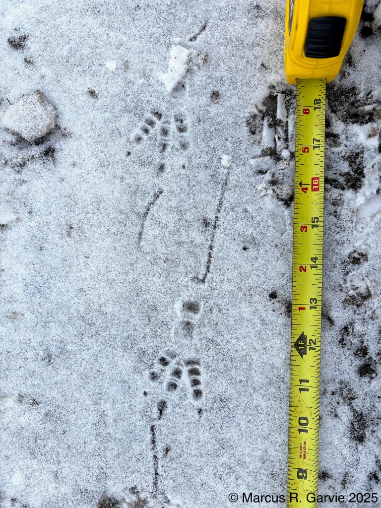
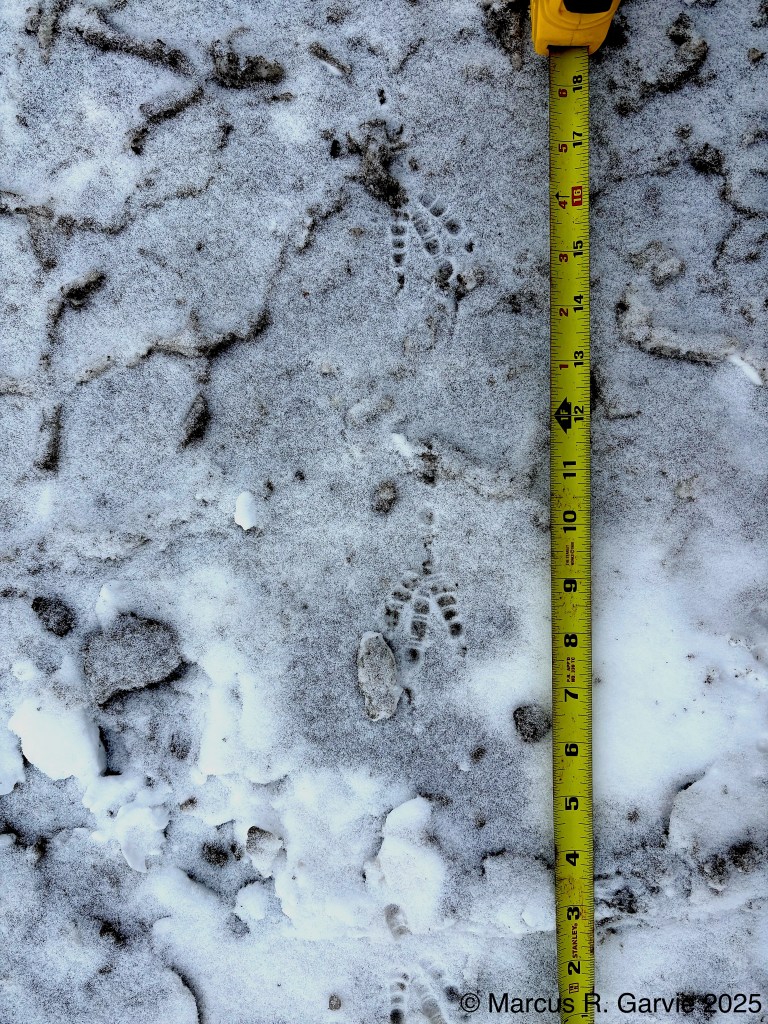
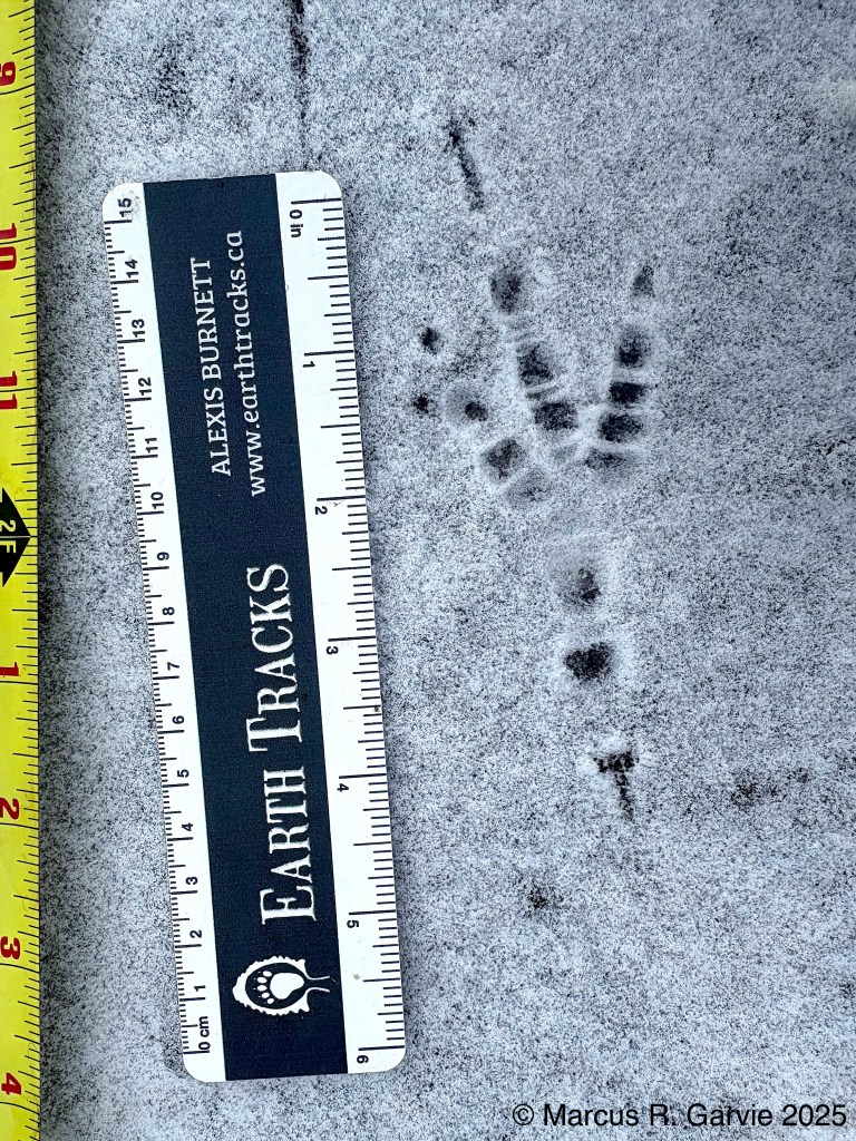
I was excited to find these tracks, as I had been looking for raven tracks for some time and wanted to compare them with crow tracks. I used the last track as the basis of the logo for my website.
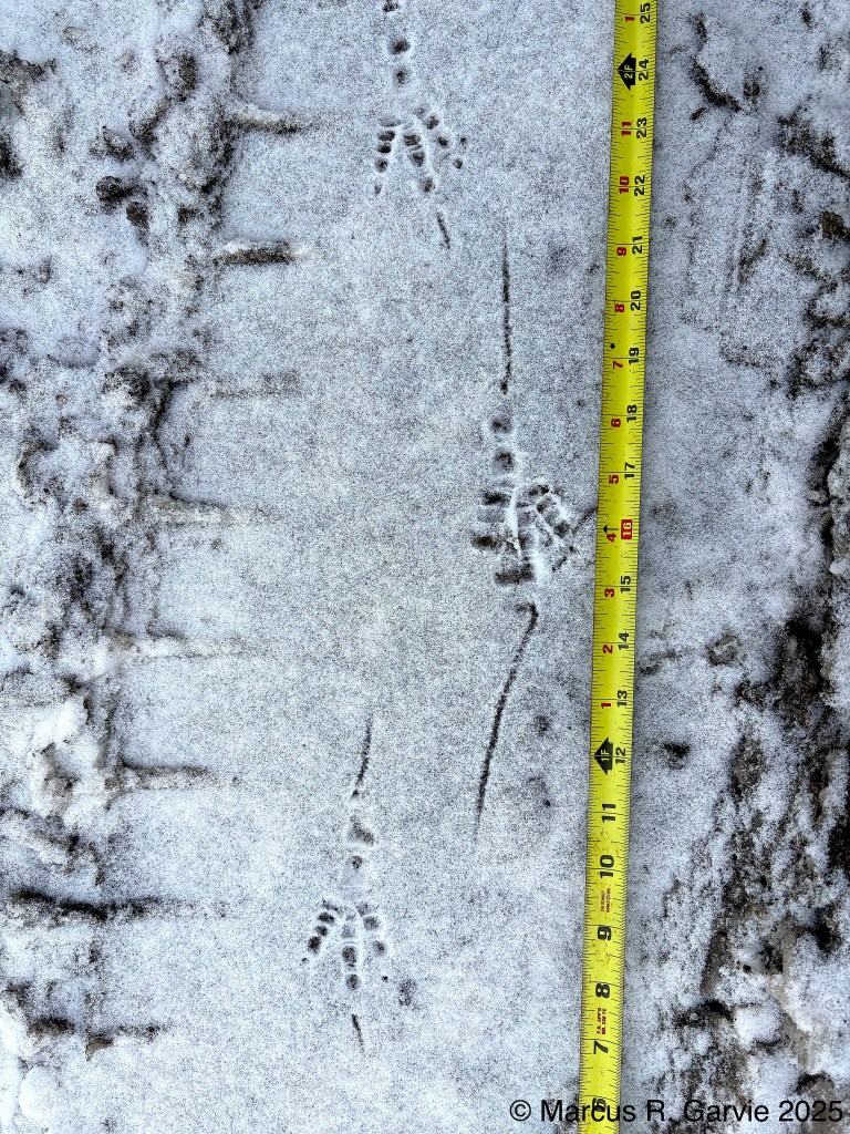
Here is a drawing comparing raven tracks with crow tracks, from [3].
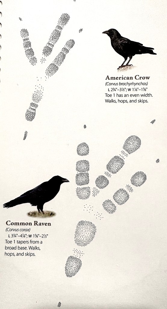
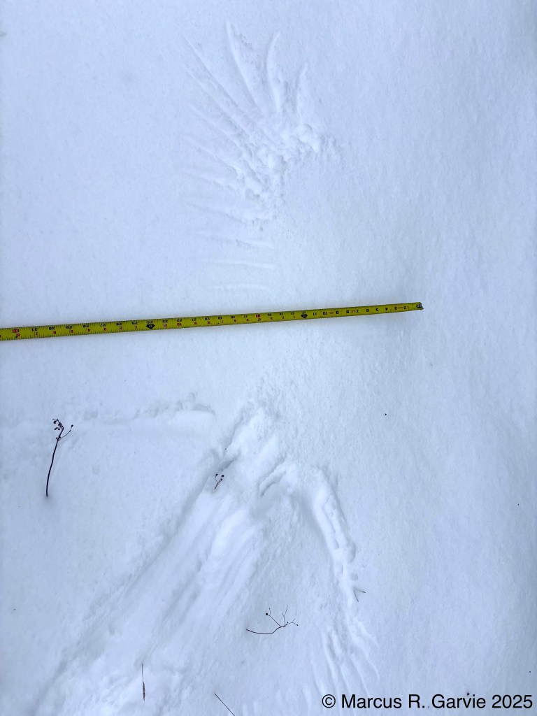
While crow tracks can be up to 3½ inches long, raven tracks can reach nearly 5 inches. It would be great to find raven and crow tracks side by side. We also saw numerous raven wing prints in the snow, made as ravens took off or landed. The best one is shown below:
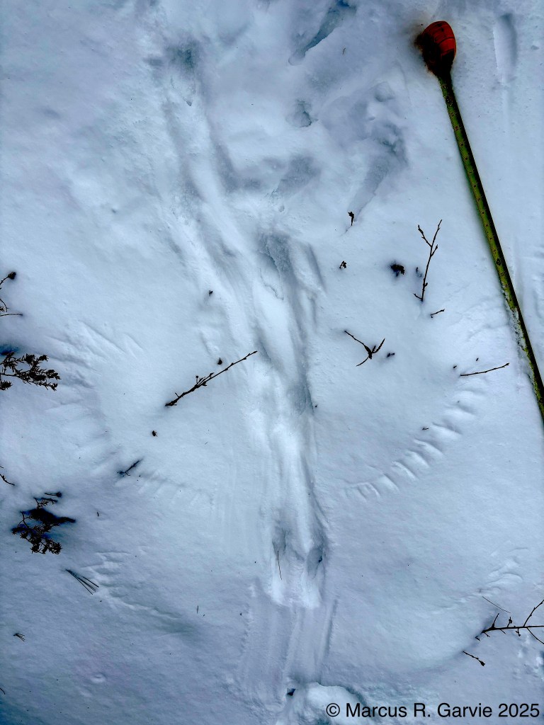
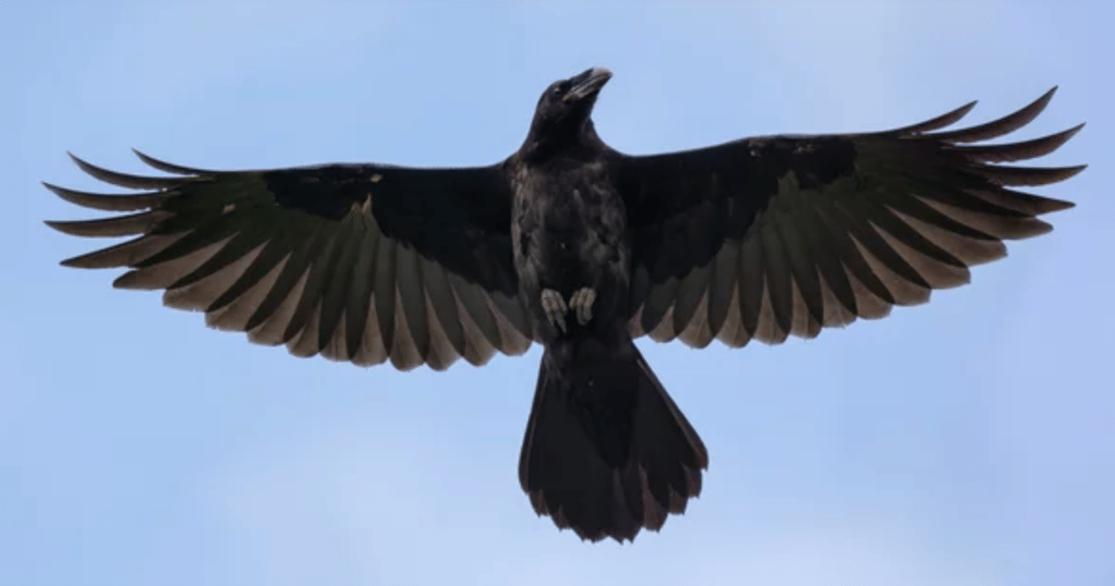
I think the bird landed at the bottom of the photo, because (a) you can see the landing spot, (b) a tail drag is visible, and (c) the feather marks from the primaries are above the secondaries. There is actually a faint imprint of where the raven first landed, and then made a hop before the wings hit the ground with more force. It helps me to be reminded of what a raven looks like in flight (taken from the internet):
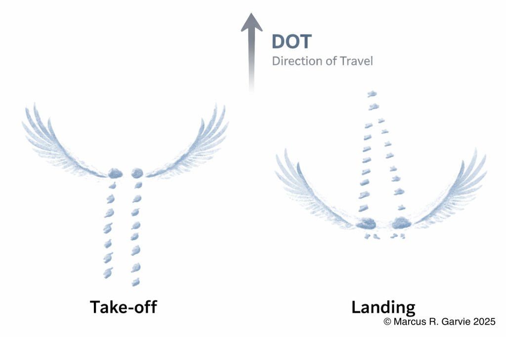
Here, I think we have another landing near the bottom of the picture. The wing print at the top would appear to be from a raven flying in the opposite direction.
I think the wings will be concave-up (“U-shaped”) in the direction of travel. Thus, the following diagram summarizes what we see for a landing and take-off:
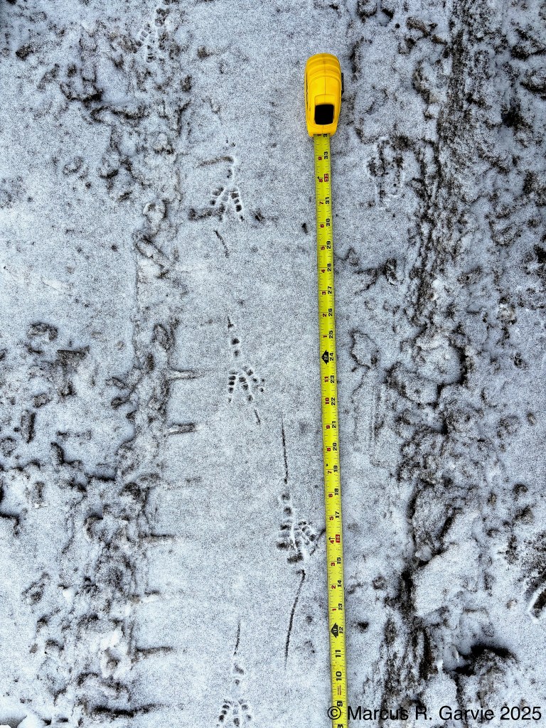
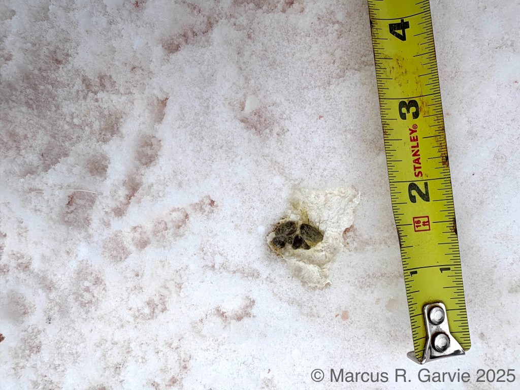
The large number of ravens near the deer carcass provided a rare opportunity to observe what appears to be raven scat. Raven tracks are also visible in the same image.
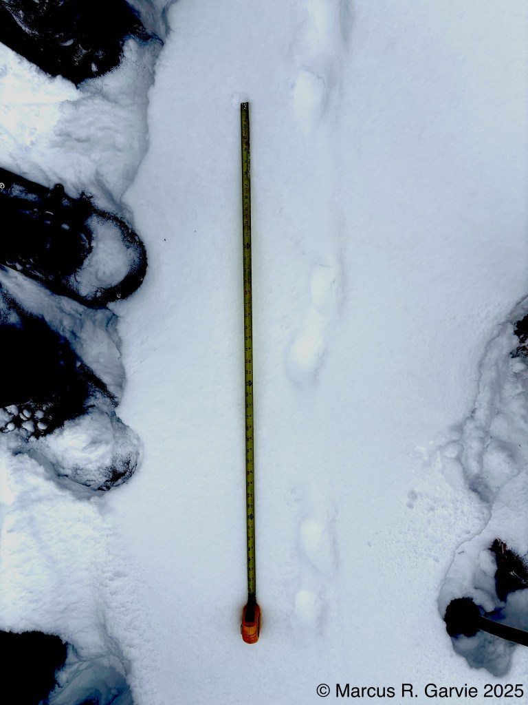
After finding the raven tracks, we discovered the tracks of southern flying squirrels and followed a moose trail. At regular intervals along the trail, we could see where the moose had browsed on small branches, exposing green wood. We found several moose beds, shown below:
If we look carefully at some of these photos, we can make out the impression of the rump, the area where the head would have been, and the typical leg positions: the front legs folded beneath the body and pointing backward, and the hind legs folded forward.
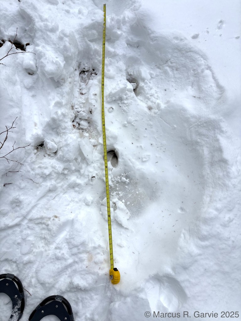
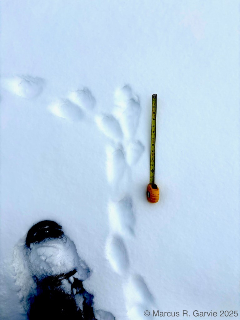
While most people in our group were following the moose trail, I was more interested in following several fisher trails. It seems that their baseline travelling gait is a 2 x 2 lope:
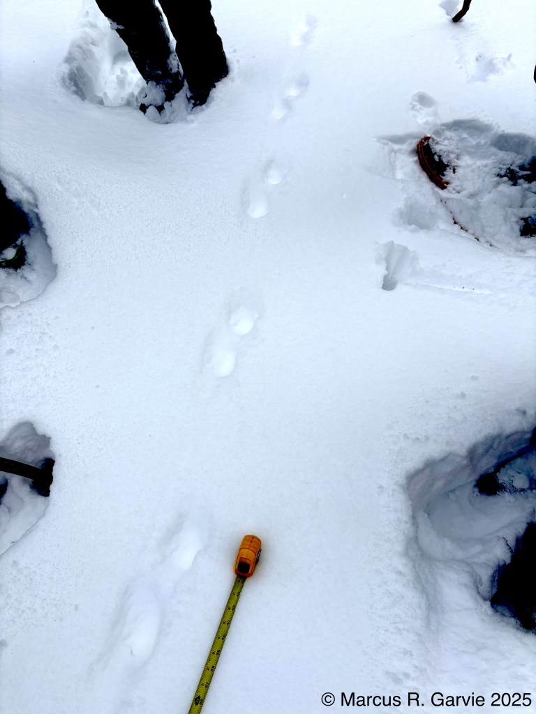
In deep snow like this, with no clear toes showing (at least in my photo), I’m not sure of the D.O.T. Here is a close-up:
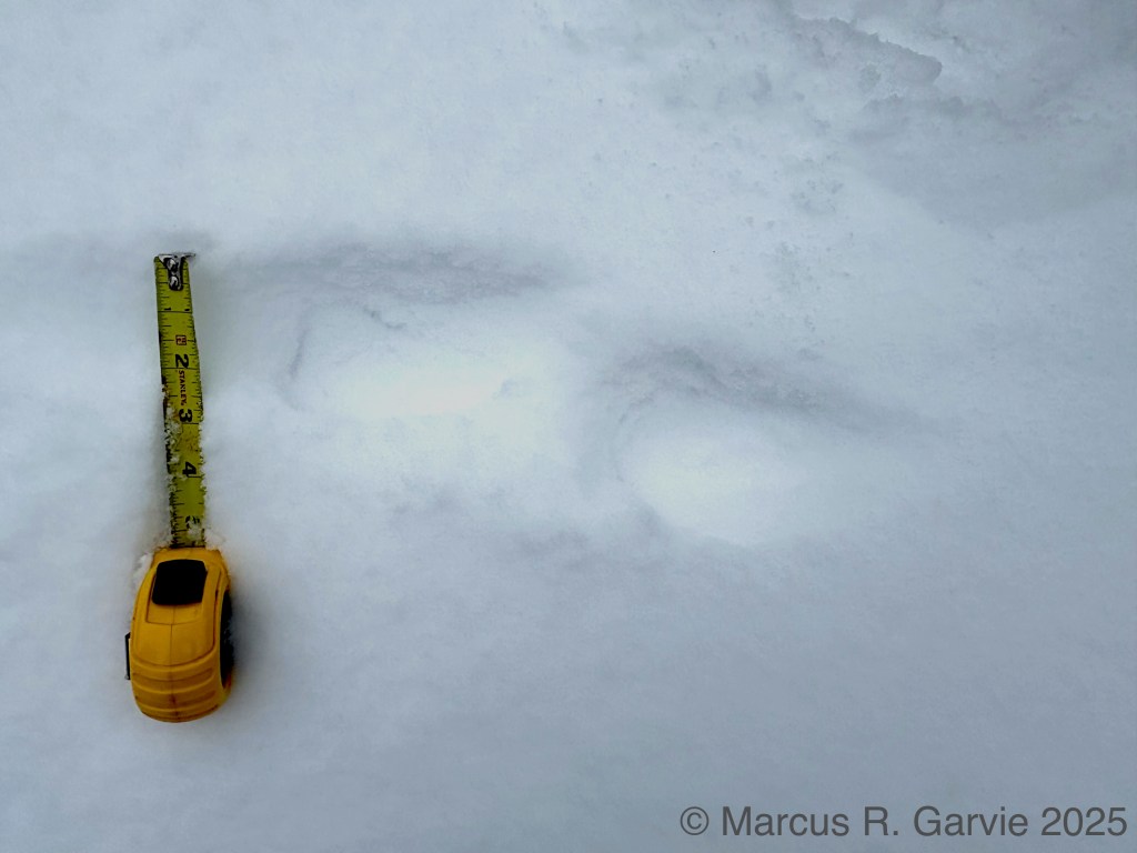
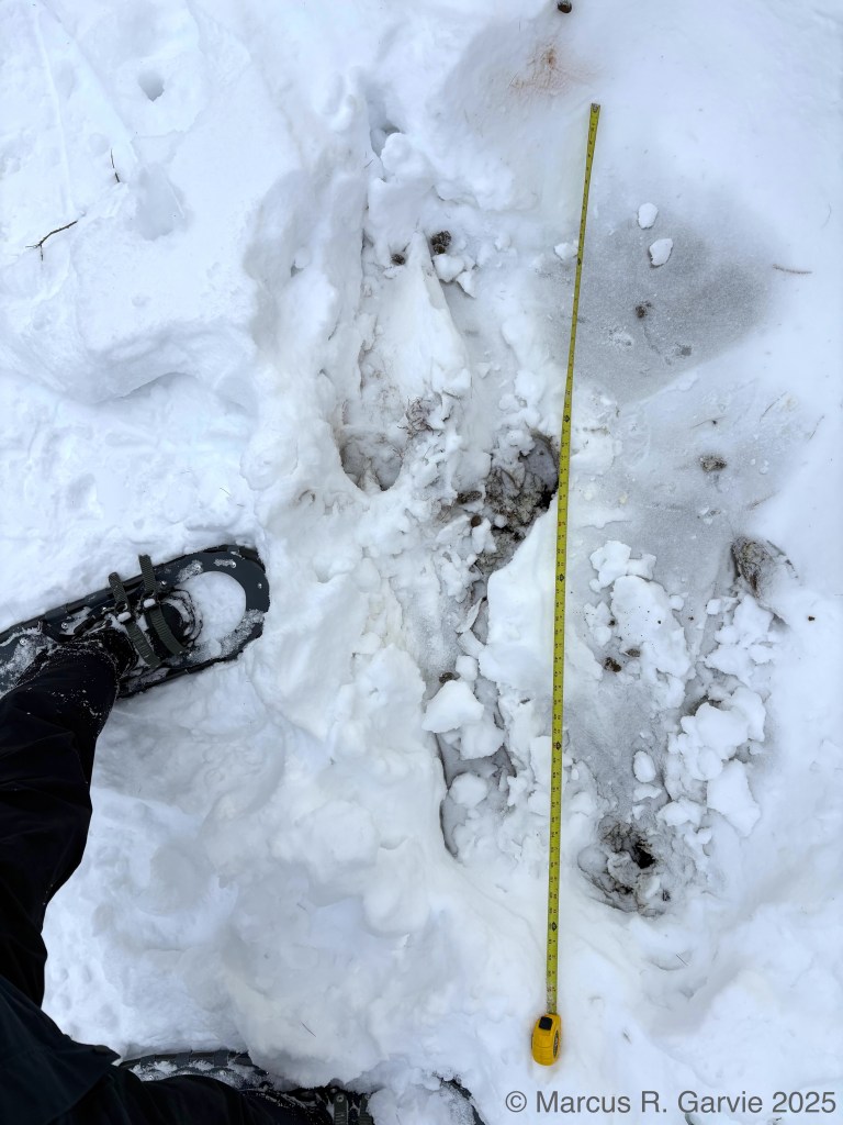
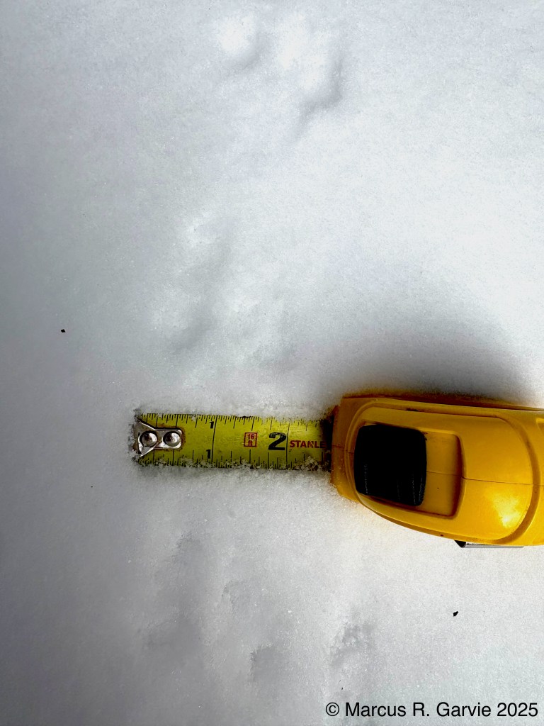
From this photo, I estimate the trail width to be about 5 inches. The individual (double) tracks are not distinct enough to estimate track length or width. In the next photo, however, the tracks are clearer, and I believe the direction of travel (D.O.T.) is from the top of the image because (a) each double set has drag marks trailing behind it, and (b) the leading edge of each double print shows the shape of the foot. Please correct me in the comments if you think I am mistaken.
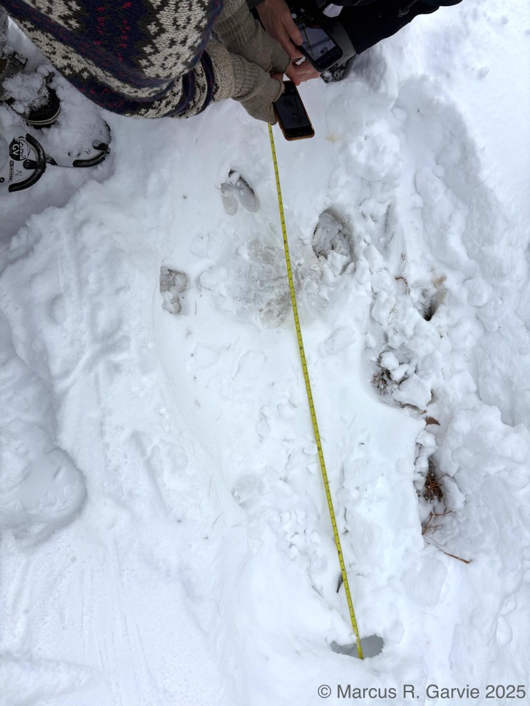
In the next photo, we see the fisher changing gait to a bounding pattern as it goes slightly up a hill:
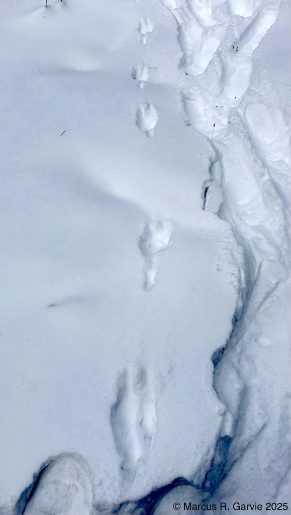
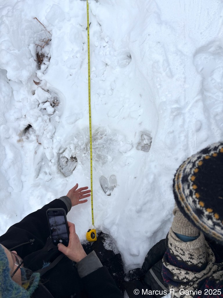
At the top of the hill, we see impressions from all four feet where the fisher stopped, possibly using the spot as a vantage point.
Final thoughts:
There were many more observations that I did not have time to describe, or that lacked sufficient detail for me to figure out. For example, in the photo below, are we seeing a squirrel bounding pattern?
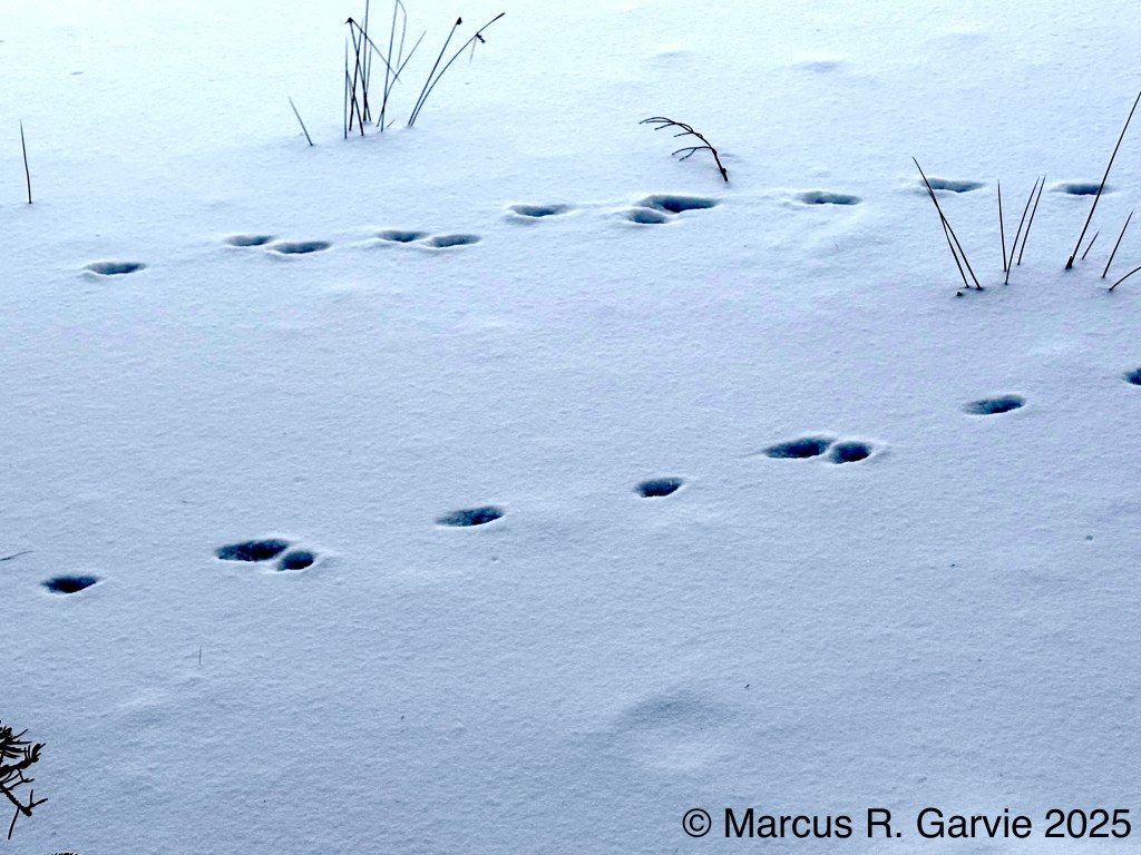
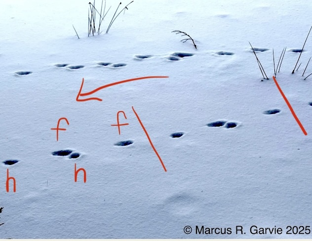
And in the canine tracks below on the frozen water, what is the animal’s gait?
PS:
Diana Clements shed some light on this last track sequence. She identifies the gait as a “slow lope”, and the groups of 4 tracks are shown below:
This is illustrated in [1]:
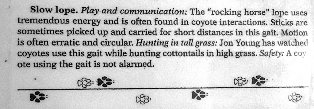
However, I do notice that the lope illustrated here is of the rotary type, while my picture seems more of a tranverse type.

Leave a comment