Date: December 6, 2025
Place: I spent the weekend at the house of Diana Clements, a fellow tracker, who lives in a remote, forested area of the Parry Sound District, east of Highway 400, north of Nobel, and southwest of Nine Mile Lake, surrounded by lakes and wetlands. We used this location as a base for tracking in the area. On the Saturday (Dec 6) we tracked in central Parry Sound District near Manbert, west of Highway 69, along Highway 529, north of Sturgeon Bay Provincial Park and northeast of Pointe au Baril, in a lightly developed forest-and-lake landscape.
Weather conditions: approximately 6 inches of fairly fresh snow was present, with light additional snowfall occurring sporadically. Temperatures ranged around the −10 °C mark.
References:
– [1] ‘Mammal Tracks & Sign: A Guide to North American Species’, Mark Elbroch, Stackpole Books (1st Edit), 2003
– [2] ‘The Tracker’s Field Guide: A Comprehensive Manual for Animal Tracking’, James Lowery, A Falcon Guide (2nd Edit), 2013
– [3] ‘Animal Tracks of the Midwest’, Jonathan Poppele, Adventure Publications (2nd Edit), 2022
– [4] ‘Bird Tracks & Sign: A Guide to North American Species’, Mark Elbroch and Eleanor Marks, Stackpole Books (1st Edit), 2001
Observations:
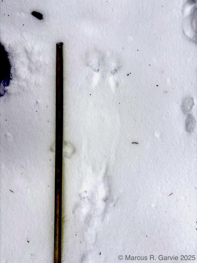
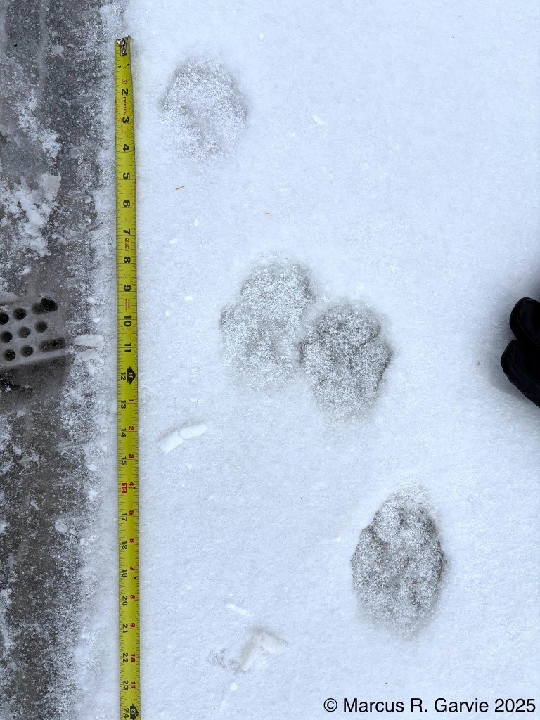
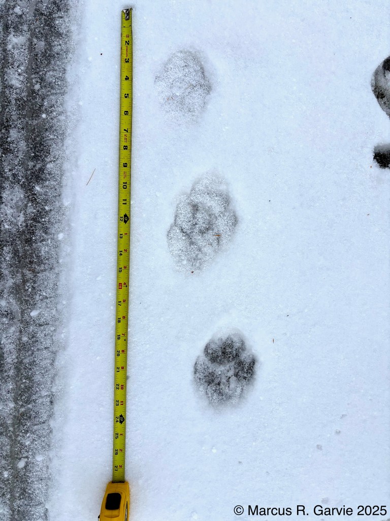
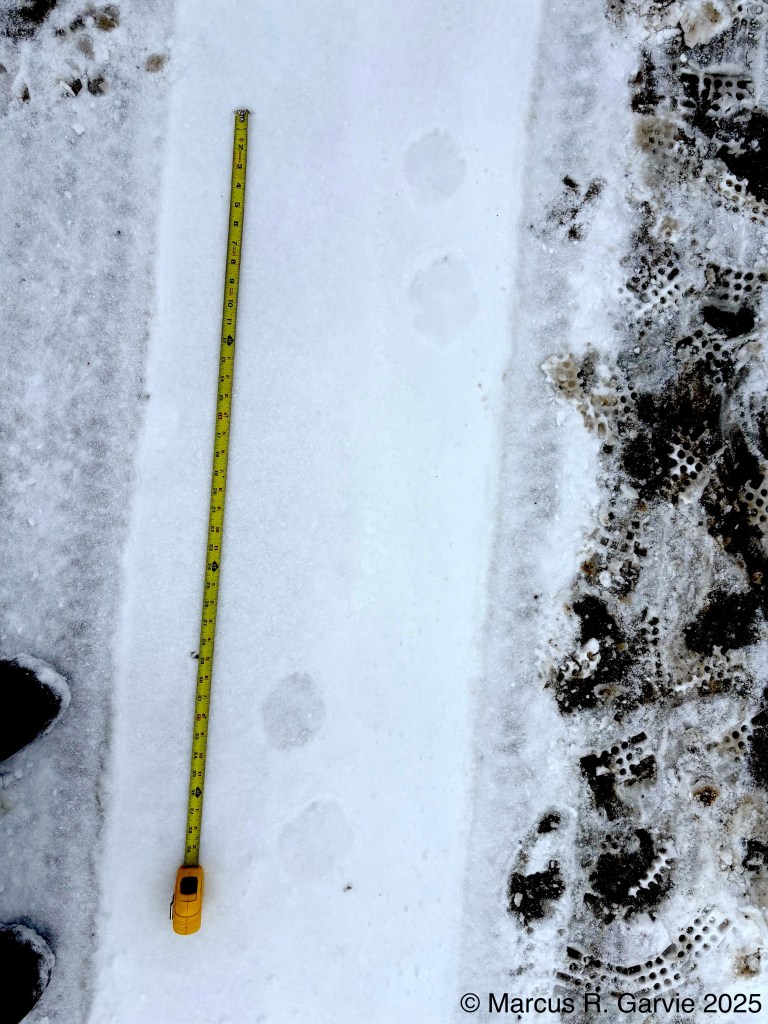
We began by driving along Hwy 529 looking for tracks in the new thin layer of snow. We found otter tracks crossing the road:
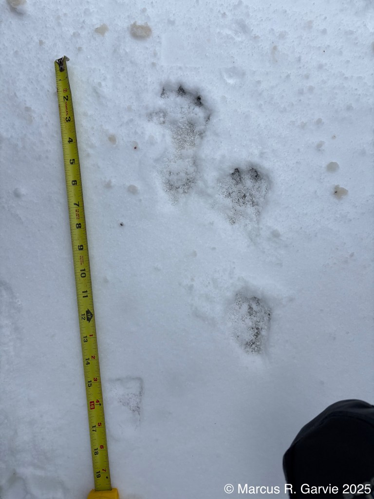
I believe the gait in the first photo shows a (transverse) lope, with the tracks (bottom-to-top) RF, RH, LF, LH. This is very similar (but a mirror image) to photo D on page 257 of [2]. Here is a drawing reproduced from [1]:
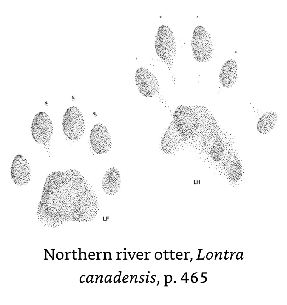
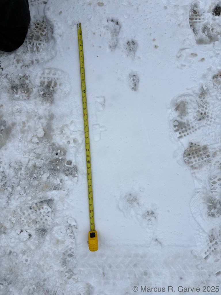
Both hind and front feet have 5 toes. Notice the larger hind track with the lower (inside) toe 1. Apparently webbing shows in clear hind prints. Tracks are 2 inches or more in width. I think I can see the lower toe 1 in the LH track and the track sizes are about right. In [2] they talk about the “characteristic weasel-shaped heel pad”, which presumably refers to the ‘C’ shape. The real clincher was the long slide marks leading to and from these tracks:
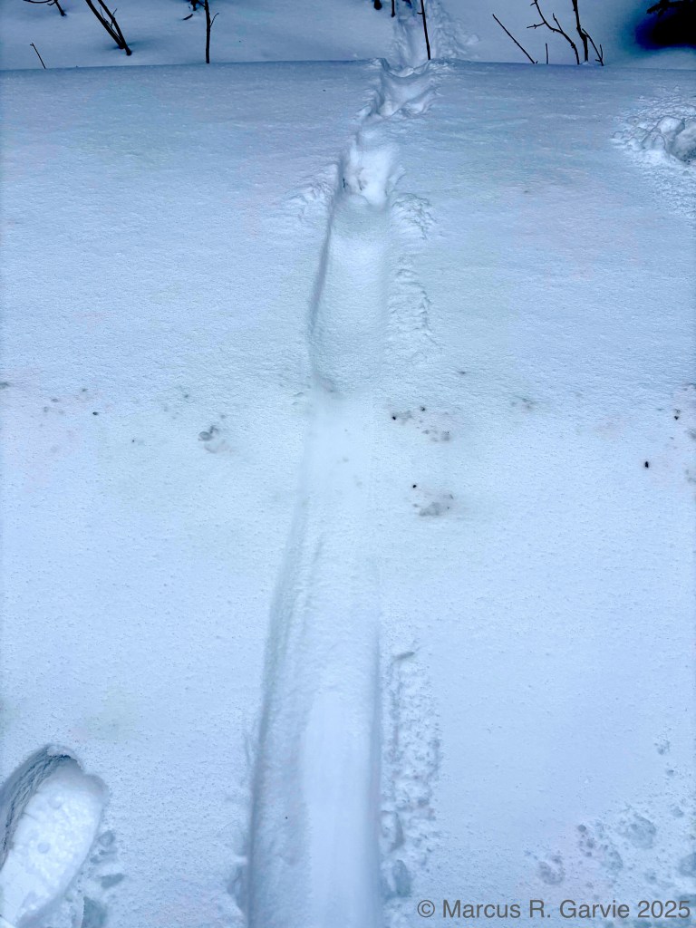
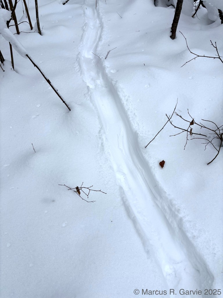
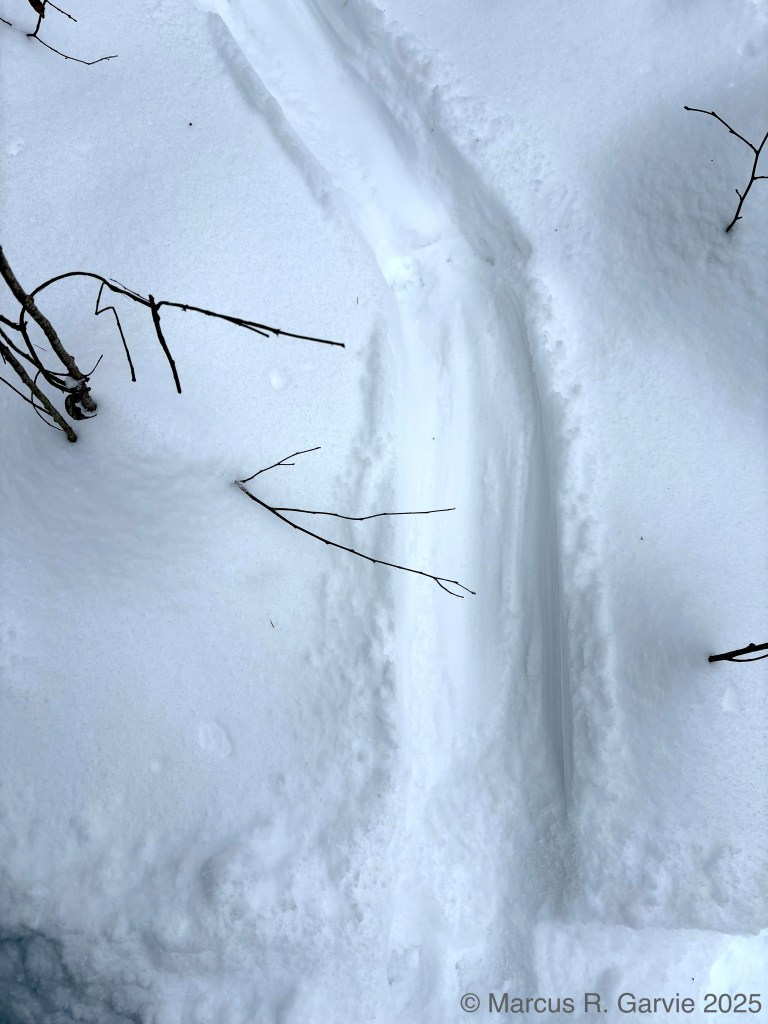
According to https://www.boundarywatersblog.com/otters-sliding-rugby-sledding/?utm_source=chatgpt.com otter slides are 6 – 10 inches wide, which is consistent with what I measured here. Later we came across otter scat (with a ‘fishy’ smell) and urine near a frozen pond / wetland area, with tracks on the ice in a “boxy gallop-modified bound”, as shown on page 186 of [1] (thanks Alastair Strachan for pointing this out to me.).
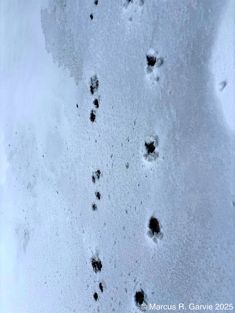
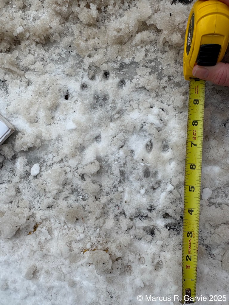
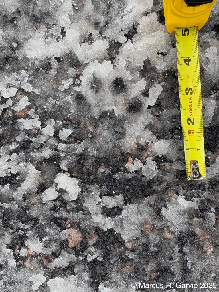
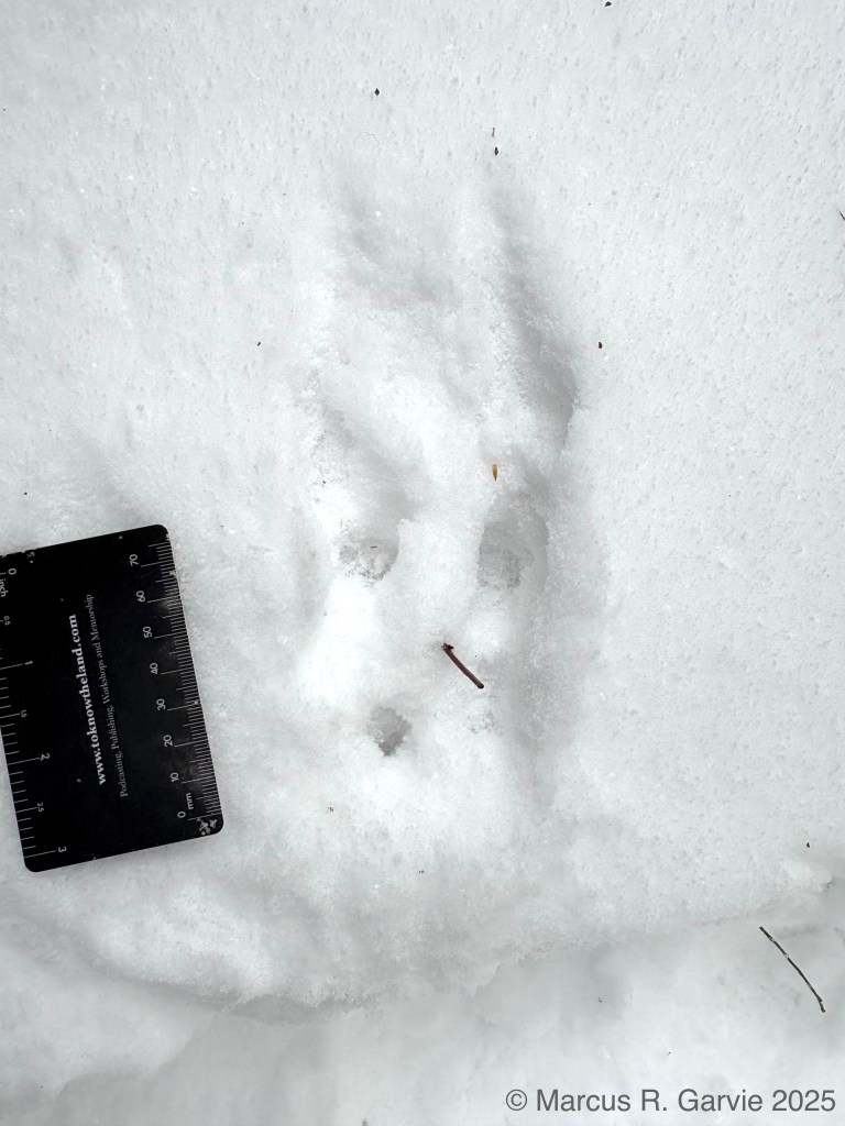
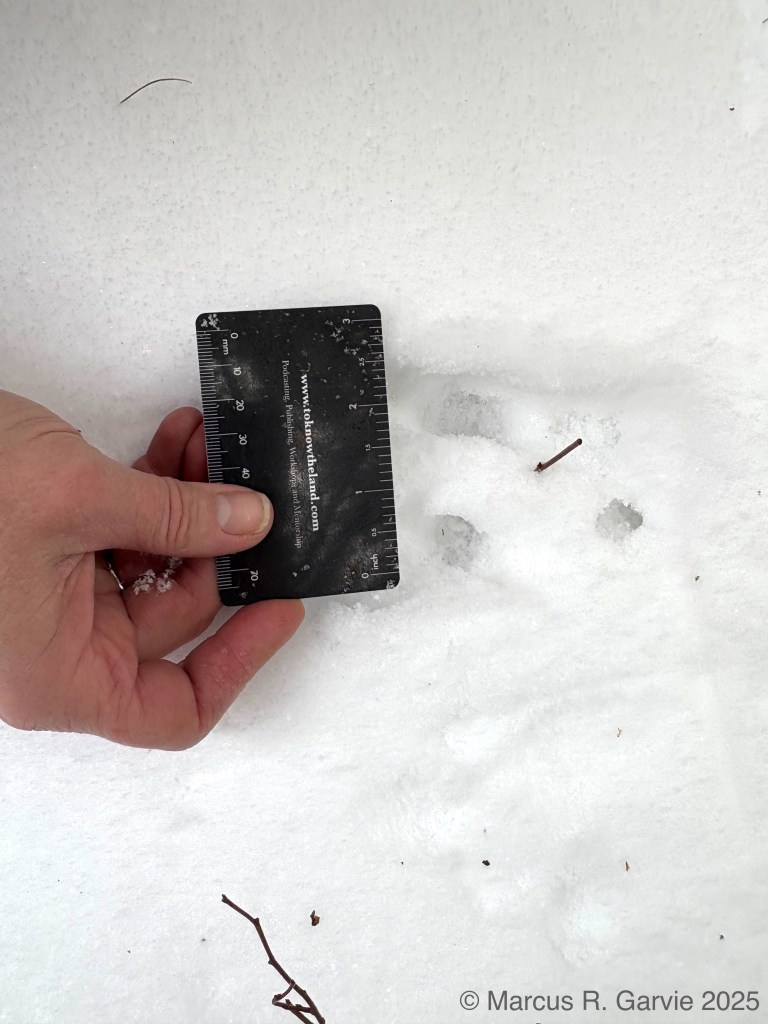
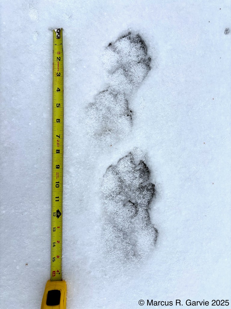
In the first photo the nearest set of tracks was from a canine.
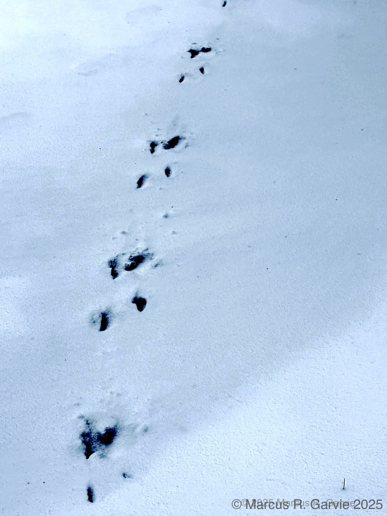
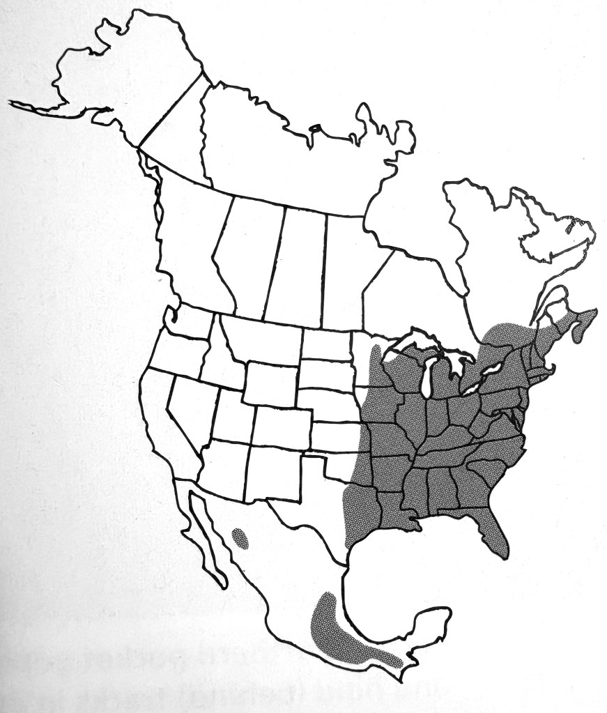
Next we found what Alexis Burnett (Earth Tracks) recognized as southern flying squirrel tracks. These squirrels are rarely seen because they are nocturnal and don’t actual fly – they glide. There is also a larger northern flying squirrel that generally lives farther north in Canada. The distribution of the southern flying squirrel is shown below (from [1]), which includes our area:
The track patterns are similar in size to a red squirrel, but there are several features that distinguish one from the other. Firstly, because of the membrane that connects front feet to the hind feet the flying squirrel can leave ‘boxy’ patterns in the snow after it has glided to the ground. Secondly, this squirrel may bound, but more often hops so that the front tracks appear in front of the hind tracks. Is this what we are seeing in the photo below? That would seem to depend on the direction of travel and I really can’t tell here. I guess this is where experience (“snow time”) counts.
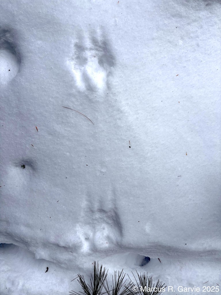
Looking at the measurements for trail width and group length for southern flying squirrel, northern flying squirrel, and red squirrel, there is a fair amount of overlap for bounds/hop (see [1]):
southern flying squirrel
– group length: 1 1/2 – 4 in
– trail width: 1 5/8 – 3 in
northern flying squirrel
– group length: 2 – 7 in
– trail width: 2 3/4 – 4 1/4 in
red squirrel
– group length: 2 – 11 in
– trail width: 2 7/8 – 4 3/8 in
My very rough measurements for the photos above:
– group length: 4 in, 3 in
– trail width: 3 1/2 in, 3 in
I’m not sure how to interpret this. I guess being able to distinguish between these different squirrel species is largely a matter of experience. The next day we found flying squirrel scat that was falling from a rotten tree hole. The pieces of tree bark suggest a woodpecker was maybe responsible for the ‘rain’ of scat and debris. I include the photos here as we were just discussing this species:
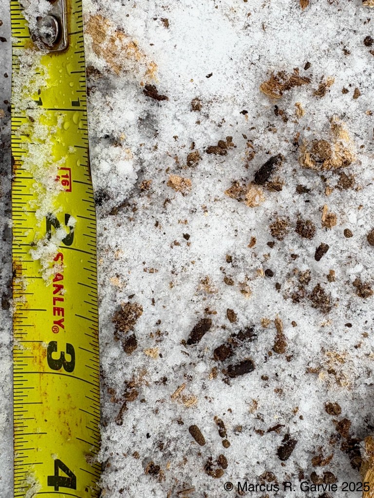
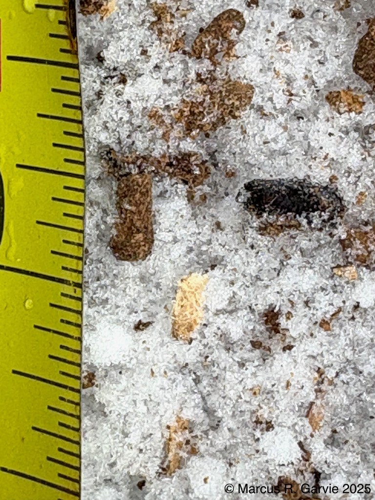
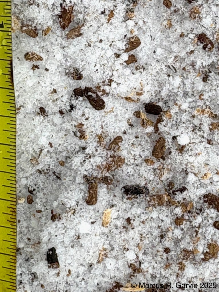
I estimate that these scat are tiny: around 1/16 – 3/32 in diameter and around 3/16 – 4/16 in long, much bigger than e.g. red squirrel scat. According to [1], southern flying squirrel scat is in the range 1/16 – 5/32 in diameter and 3/16 – 5/16 in long (p. 499 of [1]). Also, flying squirrel scat accumulates in cavities and hollows, while red squirrels drop their scat at random [1]. I’m guessing the shape of flying squirrel scat is also distinctive. The shape is tubular with flat ends, unlike red squirrel scat that is rounded, see e.g. https://wondermyway.com/tag/red-squirrel-scat/.
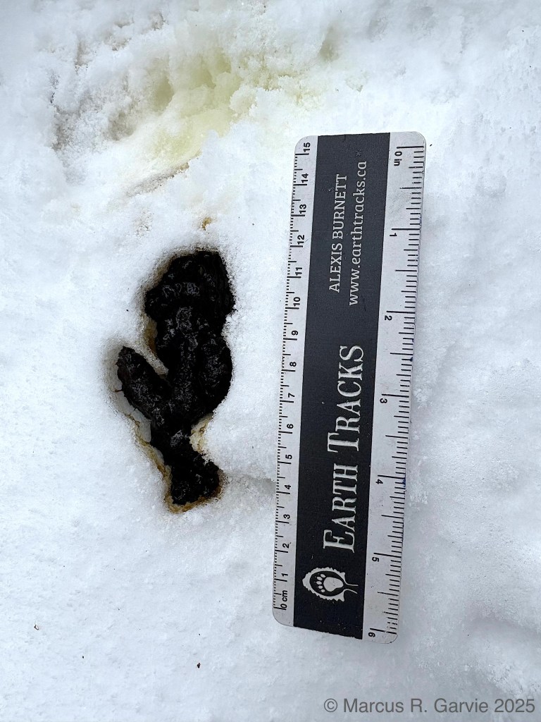
Later, we found black bear sign on a wooden utility pole along the side of the road:
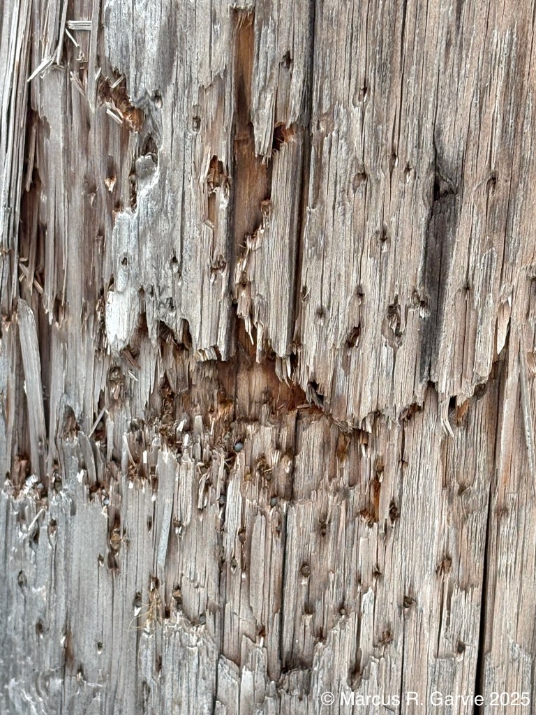
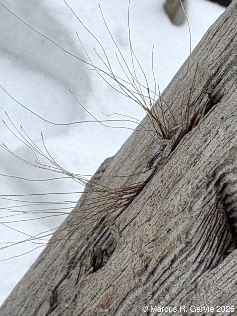
The first photograph shows horizontal bite marks made by a bear, while the second shows trapped bear hair. Apparently, bears will often stand upright on their hind legs and rub their backs against a telephone pole, then turn their heads to bite the pole, see
https://bear.org/bear-facts/marking-trees-and-poles/
This tree rubbing behaviour is interpreted as a form of scent marking and communication among bears, see
Much of our day was spent tracking (and trailing) wolves, which I assume were Eastern Wolves (Canis lupus lycaon), native to the Great Lakes region and southeastern Canada. This species, also known as the Algonquin wolf, is larger than a coyote but smaller than a Gray Wolf (Canis lupus), and is widely believed to represent a genetic mixture of these two canids.
https://www.ontario.ca/page/eastern-wolf?utm_source=chatgpt.com https://en.wikipedia.org/wiki/Eastern_wolf
Alexis Burnett (Earth Tracks) describes the wolves we trailed in a Facebook post at https://www.facebook.com/alexis.burnett.752.
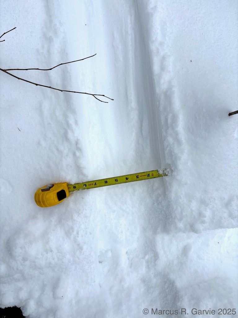
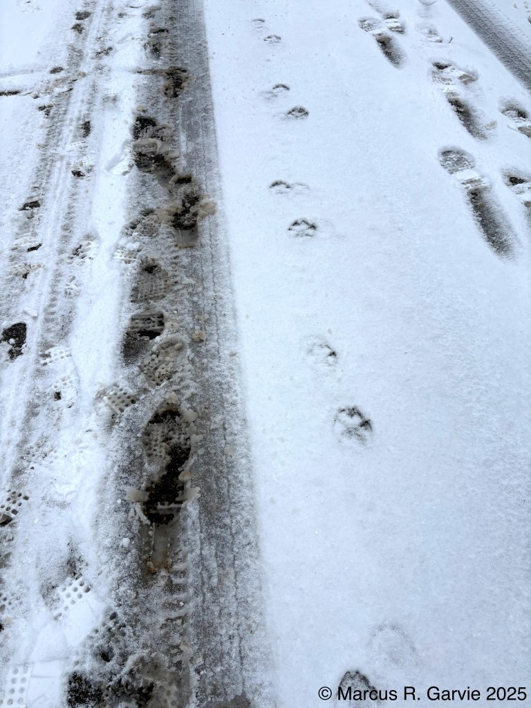
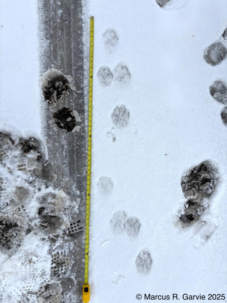
Based on the comment above regarding the relative sizes of coyotes and Gray Wolves, it would be interesting to examine the track sizes of the wolves we trailed to see whether this size difference is reflected in their tracks. Standard tracking references typically cover Gray Wolves and Red Wolves, but not the Eastern Wolf (probably, because they focus on the US more than Canada). Here are some photos of where we initially found the wolf trail on a road:
Ok, now let’s look at some measurements from [1]:
(Eastern) coyote meaurements:
| Measurement | Range (in) |
|---|---|
| Front track length | 2 5/8 – 3 1/2 |
| Front track width | 1 5/8 – 2 7/8 |
| Hind track length | 2 3/8 – 3 1/4 |
| Hind track width | 1 5/8 – 2 3/8 |
| Stride (side-trot) | 20 1/2 – 30 1/2 |
| Group length (side-trot) | 6 – 13 |
Gray Wolf measurements:
| Measurement | Range (in) |
|---|---|
| Front track length | 3 3/4 – 5 3/4 |
| Front track width | 2 7/8 – 5 |
| Hind track length | 3 3/4 – 5 1/4 |
| Hind track width | 2 5/8 – 4 1/2 |
| Stride (side-trot) | 26 – 39 |
| Group length (side-trot) | 7 – 15 1/2 |
And now for measurements (the stride and group length measurements were recorded from the 5th picture where I assume the gait is a side-trot – see also the 1st picture).
Observations from the field:
| Measurement | Observed value (in) |
|---|---|
| Front track length | 4 3/4, 4 3/4 |
| Front track width | 3 3/4, 3 1/2 |
| Hind track length | 3 3/4, 4 1/4 |
| Hind track width | 3 1/4, 3 1/4 |
| Group length (side-trot) | 11 1/2 |
| Stride (side-trot) | 28 1/2 |
Now these measurements surprised me as they clearly fall within the Gray Wolf measurements, and outside the coyote measurements (except for stride and group length). Could our measurements actual be from Gray wolves? Looking at the map in [1] the southern tip of the range for Gray wolf is just above Lake Huron, so I guess it’s possible.
Later we came across woodpecker sign on a tree (Red Pine ?), shown below:
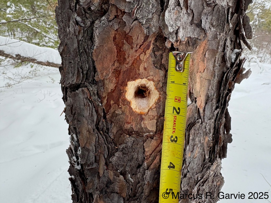
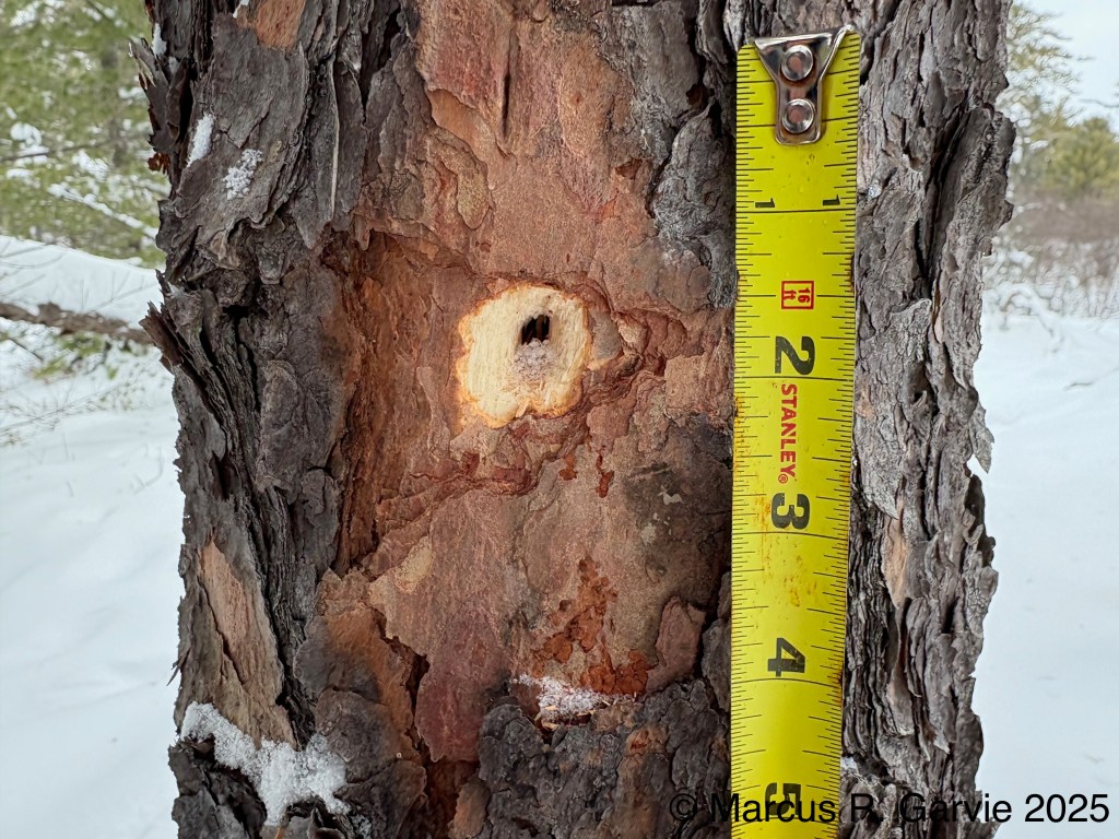
My best guess is that this is from a Pileated Woodpecker, although I thought someone in our group mentioned another woodpecker. Is the Pileated Woodpecker the only woodpecker that can ‘hammer’ holes in living trees?
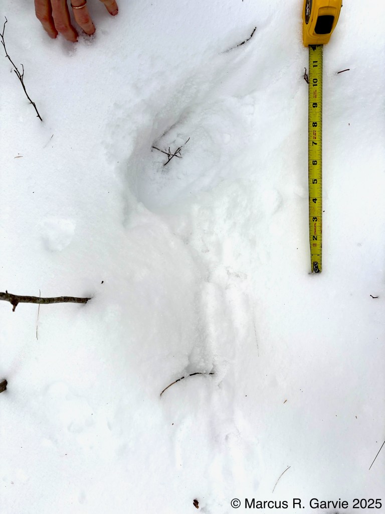
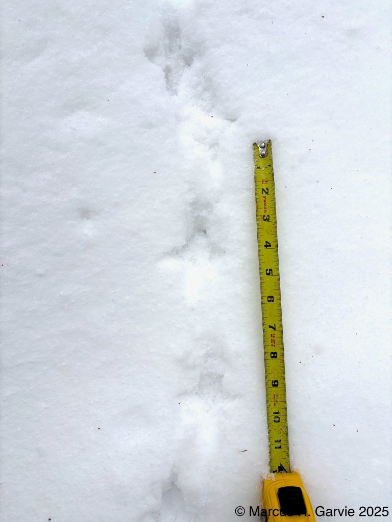
Finally, we found Ruffed Grouse tracks and sign. In the first photograph, we see where the grouse landed and then walked to the bottom of the photo. In the second photograph, the direction of travel is from top to bottom, and the tracks measure approximately 2 1/4 inches long by about 2 inches wide, consistent with the measurements given on page 127 of [4]. Ruffed Grouse have partial webbing between toes 2 and 3 and between toes 3 and 4, although there is insufficient detail in my photograph to see this clearly. In the final photograph, the tracks lead to a steep snowbank, where numerous wing impressions are visible. Was the grouse attempting to climb the snowbank while simultaneously flapping its wings?
Final thoiughts:
I realize that I need to take better notes and more measurements while tracking. This became particularly clear with the Flying Squirrel tracks, where I was unsure of the direction of travel. My biggest takeaway from this trip came from something Alexis Burnett (Earth Tracks) said while we were trailing the wolves. He encouraged us to pay close attention to changes in gait (for example, a walk shifting to a bound, or a trot slowing to a walk), especially when there is an obvious change in speed. In such situations, we should try to understand what prompted the change in behavior. For instance, when I first encountered the tracks on the road, the wolves were moving in a side-trot, but when they reached the deeper snow at the road’s edge, the gait changed to a bound – presumably to move more efficiently through the deeper snow. Alternatively, it is possible they were reacting to an approaching vehicle and moving quickly for cover.

Leave a comment